News
China Completes Marine Geophysical Survey East of Taiwan Island
China has completed a comprehensive marine geophysical survey in waters east of Taiwan Island, with authorities saying the operation will improve unde...
By Wavers Multimedia
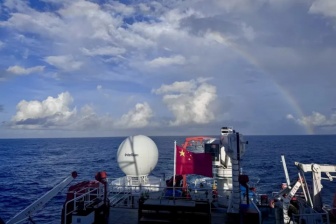
The survey was conducted by the Second Institute of Oceanography under the Ministry of Natural Resources from August 10 to August 31.
During the operation, researchers used a combination of advanced marine survey methods, including multibeam sonar, multichannel seismic exploration, ocean-bottom seismometers, and gravity and magnetic measurements.
The work generated environmental and geological data covering seabed topography, sedimentary layers, deep geological structures and geophysical fields.
The newly collected information is expected to help researchers examine the geological and geophysical characteristics of the seabed in greater detail. Areas of interest include seabed sediments, tectonic structures, the deeper structure of the Earth's crust and the geological evolution of the region.
Authorities also said the survey data would provide a scientific basis for the comprehensive management of waters that China considers to be under its jurisdiction in the area.
In addition, the findings are expected to contribute to the development of a unified spatial planning database, giving researchers and authorities a broader scientific dataset for marine planning and management.
The completion of the survey marks another step in efforts to improve marine geological research and understanding of the waters east of Taiwan Island.